Connect this guide with the rest of your visit in the Helsinki trip planner. Read how the research is made and what its sources establish.
At a glance
Start here
- Töölönlahti places an evolving green space beside the cultural centre.
- Central Park forms a long north-south forest and recreation corridor.
- Viikki protects wetland and migration habitat, so reserve rules shape movement.
- Seurasaari combines a year-round public island park with a separately operated seasonal museum.
01
Think of urban nature as a network
The city’s route pages connect waterfront paths, nature trails, forest routes, and neighbourhood walks rather than presenting one definitive green attraction. Central Park stretches from the Töölönlahti side toward Helsinki’s northern boundary. The Vanhankaupunginlahti system joins wetlands, fields, forests, boardwalks, and bird observation. Western routes connect cultural sites and Seurasaari with shoreline landscapes.
A network perspective changes trip planning. Visitors can choose a layer that fits their interest instead of searching for the best park. The centre offers an urban bay landscape; Central Park offers length and forest continuity; Viikki prioritises habitat and observation; Seurasaari combines island nature with cultural history. Exact trail conditions and restrictions still need a current check.
- Choose habitat and purpose before choosing distance.
- Use the city’s current route maps for entrances and connections.
- Treat protected-area rules as part of the route design.
02
Töölönlahti is a threshold, not a finished postcard
Töölönlahdenpuisto sits in the inner city among major cultural institutions and forms part of the green zone around Töölönlahti and Eläintarhanlahti bays. The City of Helsinki is also planning and carrying out changes in the area. That means its value lies partly in being an evolving civic landscape rather than a fixed historic garden.
Use it as an introduction to the proximity of water, park, railway, and public architecture, but read the latest construction notice before expecting a particular path or quiet edge. The park also marks the southern relationship of Central Park, whose long green structure continues far beyond the cultural centre. Urban nature here is visibly negotiated alongside other city functions.
- Check the current project notice for route changes.
- Observe how cultural buildings frame the green space.
- Use the bay as a conceptual beginning, not a promise of a continuous walk.
03
Central Park makes a forested spine through Helsinki
Helsinki Central Park spans roughly ten kilometres from the Töölönlahti area north toward Haltiala. The city describes a changing landscape of urban park, forest, meadows, fields, recreation routes, and nature reserves. Residents use it for ordinary movement as well as outdoor activity, which makes it infrastructure for daily life rather than an isolated destination landscape.
A visitor does not need to walk the whole spine. Choose a section from the current guide map according to available time and the character you want. Southern areas remain close to the centre; farther north, forest and outdoor-recreation landscapes become more prominent. Winter changes route use, and some paths become ski tracks, so a current seasonal map matters more than a universal walking instruction.
- Select one named section instead of attempting the full length by default.
- Consult seasonal route information before winter travel.
- Notice commuters and recreation users sharing the same green system.
04
Viikki puts protected wetland inside the metropolis
Viikki is part of the Vanhankaupunginlahti ecological whole, with wetland, fields, forests, arboretum, and important habitat for nesting and migrating birds. The city identifies the Viikki-Vanhankaupunginlahti reserve as Helsinki’s largest protected area. Bird platforms, trails, and boardwalk connections allow observation without turning the reserve into unrestricted ground.
That last distinction is essential. Protection regulations limit movement in particular reed, water, forest, and seasonal areas; pets must not roam, and some activities are prohibited. Follow the current map and signs rather than improvising a shortcut toward wildlife. The best visit makes distance and patience part of observation, allowing the wetland to remain habitat first and visitor scenery second.
- Use designated paths, platforms, and boardwalks.
- Read current reserve restrictions before starting the route.
- Bring binoculars if observation matters; do not seek closer access.
05
Marked routes can teach more than they connect
Helsinki’s official nature-route catalogue includes waterfront trails, local nature paths, forest routes, and trails with information boards. Some interpret ecology; others bring history and neighbourhood culture into the walk. The result is not simply a transport network for hikers but a set of reading aids for landscapes that might otherwise appear anonymous.
Choose a marked route whose subject fits the day and use its live map. Distance alone does not predict difficulty, seasonal maintenance, lighting, surfaces, or protected-area limitations. The city’s individual destination pages are the proper place for those details. A route can still be meaningful when shortened, especially if stops at boards, shorelines, or observation points replace the pressure to complete every kilometre.
- Choose by theme as well as route length.
- Open the individual area page for conditions and restrictions.
- Allow interpretation stops to determine the pace.
06
Seurasaari is both public island and museum landscape
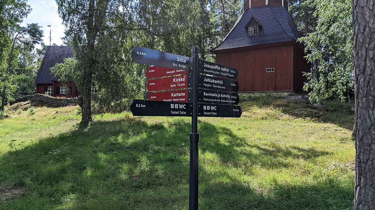
Seurasaari is connected to the mainland by a pedestrian bridge and functions as a public island park throughout the year. Its sand roads pass forests, rocky hills, wet hollows, and herb-rich areas. The city also records protected shoreline habitat and movement restrictions around the southern islets during the nesting period. This ecological setting exists independently of the museum ticket.
Within the island, the Seurasaari Open-Air Museum presents historic buildings brought from different parts of Finland. The museum operates seasonally and requires its own admission, while the surrounding public island remains a separate year-round destination. Keeping those identities distinct prevents a common planning error: assuming the museum is open whenever the bridge and park are available.
- The bridge and public island provide year-round park access.
- The open-air museum has its own season, ticket, and visitor information.
- Observe shoreline protection rules even outside museum activity.
07
Choose one layer of Helsinki’s green city
Choose Töölönlahti when the interest is the meeting of park, water, and cultural centre. Choose a Central Park section for forest continuity and everyday recreation. Choose Viikki for wetland observation under clear conservation rules. Choose Seurasaari for an island landscape where nature and cultural history occupy the same ground but follow different operating systems.
None needs to be framed as an escape from Helsinki; each is part of Helsinki. Check current routes, work sites, seasonal use, and protected-area notices, then let one landscape occupy enough time to become legible. The city’s achievement is not that nature looks untouched everywhere. It is that varied habitats and public uses remain present inside an active capital, with boundaries that visitors are responsible for respecting.
- Urban bay and civic landscape: Töölönlahti.
- Long forest structure: Central Park.
- Wetland habitat and bird observation: Viikki.
- Island nature plus seasonal cultural history: Seurasaari.
Useful answers
Reader questions
Does Helsinki Central Park begin near the city centre?
The city describes Central Park as extending from the Töölönlahti area north toward Haltiala for roughly ten kilometres. Visitors can choose one section rather than treating the entire spine as a single walk.
Sources: City of HelsinkiWhy are there route restrictions in Viikki?
Viikki-Vanhankaupunginlahti is a protected wetland and an important nesting and migration area. Current rules restrict movement and activities in sensitive places so designated trails and observation points should guide the visit.
Sources: City of HelsinkiCan I enter Seurasaari without a museum ticket?
Yes. The island is a public park reached by a pedestrian bridge and can be entered separately from the seasonal Open-Air Museum. The museum’s buildings and programme require their own current admission arrangements.
Sources: City of Helsinki; Seurasaari Open-Air MuseumIs the Töölönlahti route fixed during current park work?
No static guide should guarantee it. The city’s project page describes ongoing planning and construction in the area, so check the latest notice and map before depending on a particular path.
Sources: City of HelsinkiRead the evidence
Sources and further reading
These sources support the relevant sections above. Plans and comparisons are editorial suggestions. Check operators for current arrangements.
- Töölönlahdenpuisto Park ↗City of Helsinki · Research date 14 September 2026
Inner-city park setting, surrounding cultural institutions, bay relationship, and current redevelopment context.
- Central Park ↗City of Helsinki · Research date 14 September 2026
North-south extent, landscape types, route use, history, seasonal changes, and protected areas.
- Routes and nature trails ↗City of Helsinki · Research date 14 September 2026
Official waterfront, nature, walking, and interpretive route network and current mapping.
- Viikki nature area ↗City of Helsinki · Research date 14 September 2026
Wetland ecology, reserve status, arboretum, trails, platforms, and current conservation rules.
- Seurasaari ↗City of Helsinki · Research date 14 September 2026
Year-round bridge access, public park status, landscapes, routes, history, and protected shoreline rules.
- Welcome to Seurasaari ↗Seurasaari Open-Air Museum · Research date 14 September 2026
Separation of public island and ticketed museum, seasonal museum operation, bridge arrival, and building collection.